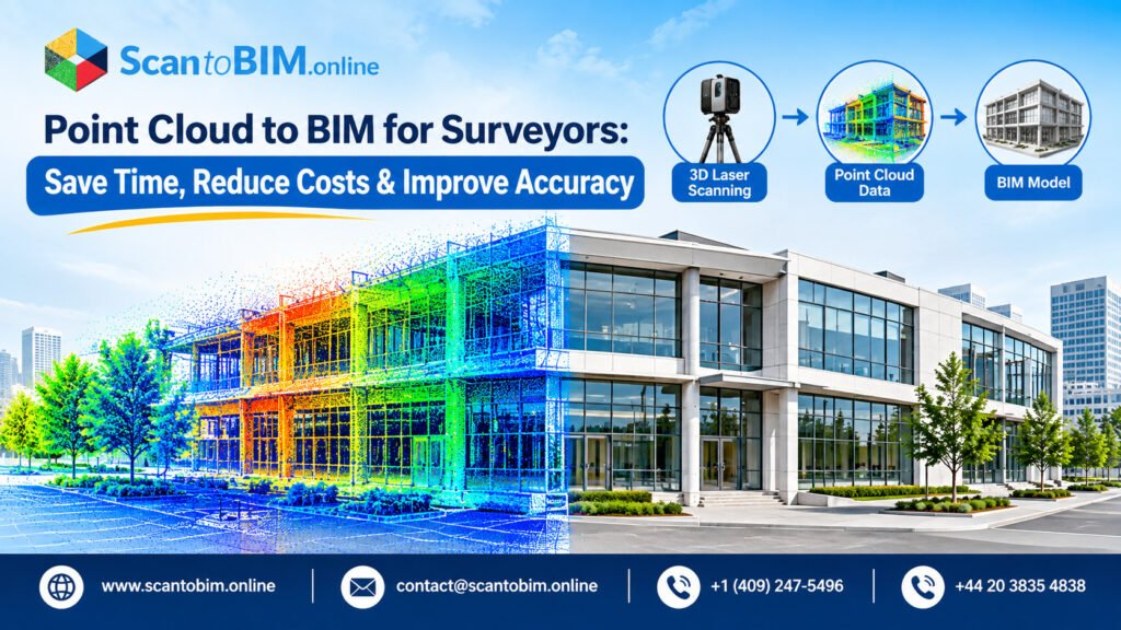
Surveying firms that still deliver 2D CAD drawings are running into a widening gap with client expectations. Architects, structural engineers and facility owners increasingly request parametric, object-oriented 3D models instead of static line drawings. Firms that cannot produce them risk losing bids to competitors who can, particularly on renovation and retrofit projects where existing-conditions accuracy drives every downstream decision.
Point cloud to BIM addresses this gap directly, converting the unstructured 3D data captured through laser scanning or photogrammetry into organized, information-rich building models that design and construction teams can use without reinterpreting raw geometry. For a surveying company deciding how to build this capability, understanding the process, the cost, and the realistic payoff is the starting point.
What Is Point Cloud to BIM for Surveyors?
Point cloud to BIM for surveying is the process of taking unstructured spatial measurement data and turning it into an intelligent, parametric building model. A point cloud is a dense collection of coordinate points captured by a laser scanner or photogrammetry sensor, carrying position, intensity, and color values but no understanding of what it represents. A raw scan cannot tell a load-bearing wall from a drywall partition; it simply records surfaces as continuous points.
Point cloud modeling bridges this gap by converting unstructured clusters into parametric BIM entities within authoring platforms such as Autodesk Revit. In a point cloud to Revit workflow, a group of coplanar points representing a wall becomes a Basic Wall family with defined thickness, height, and structural layers, so raw geometry becomes an object that carries real construction information.
For surveying firms, this conversion turns a flat drawing into a usable digital asset. A finished model supports clash detection, structural analysis, and facility management in ways that a 2D plan or an unstructured surface mesh cannot.
How Does Point Cloud to BIM Work: Point Cloud to BIM Workflow for Surveying Companies
A high-precision survey point cloud to BIM workflow follows a defined sequence rather than an ad hoc process, moving from field control through registration to finished parametric geometry in five connected phases.
-
- Geodetic control should be established through use of GNSS receivers and total stations. Targets should be tied to a known coordinate system to prevent drift over large sites.
- Capture the site with terrestrial laser scanners, or SLAM mobile mappers scanning from multiple positions to remove line of sight gaps.
- Software such as Leica Cyclone or FARO Scene can be used to register the scans, align overlapping clouds and filter out vegetation and stray returns.
- Import the unified point cloud into Revit with shared coordinates and create native parametric families for architectural, structural and MEP elements.
- Compare the completed model to the point cloud to ensure that it meets the project accuracy requirement.
Each phase is dependent on the phase before it. Weak control points early on propagate into registration errors later, and a poorly registered point cloud limits how accurately the model can represent the real building.
How Point Cloud to BIM Helps Surveyors Save Time
Traditional field surveying relies on tape measures, handheld distometers, and manual CAD drafting. Verifying a single complex element, such as a precast concrete wall panel, can take 15 to 30 minutes with physical tools. A laser scanner captures an entire structural bay in a single setup under two minutes, compressing field survey duration by 50% to 70%.
Scan to BIM for surveyors also removes a cost that rarely appears in a project estimate: the return site visit. A complete scan captures the visible environment in full, so if an engineer later asks for a dimension outside the original scope, a modeler checks the point cloud from the office instead of remobilizing a field crew.
Software-assisted feature extraction adds a further gain. Automated plane detection and object recognition can speed modeling throughput by up to 40% compared with manual tracing, according to research on BIM production methods. Firms pairing this software with an outside modeling team can run continuous production, with scans processed overnight and finished models ready the next business day.
How Point Cloud to BIM Can Reduce Surveying Costs
Laser scan to BIM workflows change the cost structure of a survey project in three ways: less field time, fewer re-visits, and fewer disputes over existing conditions. Multi-week deployments with large crews give way to one or two days of capture with a single-operator team.
Point cloud to BIM cost savings also show up after the survey is complete. Undetected clashes between existing structural framing and new ductwork cause delays and change orders once construction begins. An accurate model supports earlier clash detection, and research on BIM-driven project coordination found this kind of early review can reduce total project costs by up to 7%.
Building an internal modeling department carries its own cost, from workstations and software licenses to the salaries needed to recruit qualified modelers. Working with an outside partner converts this fixed expense into a variable, per-project cost that protects cash flow when volume shifts.
How Point Cloud to BIM Improves Accuracy
Laser scan to BIM workflows depend on accurate field capture, because accuracy is the foundation of any survey deliverable. Manual sketches and 2D approximations carry inherent risk of human error, while point cloud modeling provides an objective spatial record. The U.S. Institute of Building Documentation addresses this through its Level of Accuracy (LOA) specification, which defines five geometric accuracy tiers evaluated at a 95% statistical confidence level, so at least 95% of measured points must fall inside the assigned tolerance band.
The specification separates two ideas that are easy to confuse. Measured accuracy is the precision achieved by field equipment during data capture. Represented accuracy is how faithfully the finished Revit element reproduces that captured geometry. A model cannot be more accurate than the point cloud it was built from, so both figures belong in the project scope to avoid disputes later.
Accuracy should not be confused with Level of Development. LOD measures information density rather than geometric precision. A column modeled to LOD 400 can still carry poor spatial accuracy if built to LOA 20, which makes it unsuitable for fabrication even though it looks detailed.
What BIM Deliverables Can Surveyors Provide?
Adopting point cloud to BIM Services lets surveying firms deliver more than 2D line drawings. Depending on the client’s software and downstream use, a finished project can include:
-
- Native Autodesk Revit models (.RVT) with parametric architectural, structural, and MEP families mapped to field coordinates.
- Open BIM files (IFC) that let non-Revit clients import spatial data without distortion.
- COBie datasets linking 3D geometry to equipment serials, warranties and maintenance schedules for facility management.
- Dynamic 2D extractions (DWG or PDF) from the 3D model. The files update automatically when model geometry changes.
- High-fidelity surface meshes for Historic Building Information Modeling, capturing decay and ornamental detail on organic structures.
- Surface deviation heatmaps and floor flatness reports that flag where a slab or wall has moved out of tolerance.
Each deliverable draws on the same capture effort, so one scan can support several client needs without a return visit.
Point Cloud to BIM for Different Types of Surveyors
How point cloud to BIM for surveying is applied depends heavily on the discipline involved.
Architectural and building surveyors use point cloud to Revit workflows to document existing facilities for renovation and interior planning, capturing wall thickness, ceiling height, and facade geometry. In historic preservation work, the same captured data feeds HBIM models that quantify structural decay.
Land and topographic surveyors combine aerial photogrammetry with terrestrial LiDAR to build Civil BIM and GIS deliverables, converting terrain points into digital terrain models and earthwork calculations for design teams.
MEP and industrial surveyors model dense piping and ductwork to LOD 350 or 400 so fabricated pipe spools install without field clashes.
Infrastructure surveyors apply the same methods to tunnels, bridges, and retaining structures to track structural displacement over time.
Why Surveying Companies Outsource Point Cloud to BIM?
Survey executives facing growing demand for 3D documentation face a choice: build an internal modeling department or outsource point cloud to BIM work to a specialized partner. Several pressures push firms toward the second option.
A surveying firm’s core value sits in field data acquisition, geodetic control, and client relationships, not in tracing geometry inside Revit. Senior personnel engaged in manual modeling means they are taken away from revenue generating activities. A shortage of CAD professionals who combine Revit skill with construction knowledge makes recruiting in-house modelers slow and expensive.
Point cloud to BIM outsourcing also solves a capacity problem internal teams cannot solve quickly. A large multi-building contract can overwhelm an in-house drafting team, while a quiet quarter leaves salaried staff underutilized. A point cloud to BIM service provider operating in another time zone can process scan data overnight, so a firm’s own office closes with raw data and reopens with a finished model.
In-House vs. Outsourced Point Cloud to BIM
Comparing the two models side by side makes the trade-offs concrete.
An in-house department requires upfront investment in workstations and software licensing, plus full-time salaries and training for every modeler on staff. Production capacity is fixed to what that team can handle in a single shift, and quality control depends on senior staff reviewing geometry by hand.
An outsourced partner carries none of that infrastructure cost. Billing ties to active projects rather than fixed payroll, and production can scale from a small retail unit to a multi-million-square-foot complex without the firm hiring anyone. A dedicated review process replaces borrowed time from field staff, and time zone coverage supports continuous production.
| Evaluation Criteria | Internal Scan-to-BIM Department | Outsourced Point Cloud to BIM Partner | Operational Impact |
|---|---|---|---|
| Initial Capital Expenditure | High: Requires workstations, servers, and network infrastructure. | None: Provider maintains the required infrastructure. | Avoids upfront equipment costs. |
| Software Costs | High: Ongoing Revit, Cyclone, Scene, and plugin licenses. | Included: Software costs form part of project rates. | Reduces fixed software expenses. |
| Labor Costs | Fixed: Salaries, benefits, leave, and training. | Variable: Costs depend on project requirements. | Reduces payroll pressure during slow periods. |
| Production Scalability | Limited: Capacity depends on available staff. | Flexible: Capacity adjusts to project size and workload. | Takes on larger projects without expanding permanent headcount. |
| Turnaround Time | Limited: Production follows local working hours. | Extended: Teams work across different time zones. | Creates more opportunities for continuous production. |
| Quality Control | Internal: Senior staff manually check model geometry. | Dedicated: QA/QC teams check deviations and document findings. | Provides QA reports with native model files. |
| Technical Expertise | Variable: Specialized MEP or historic HBIM skills may be unavailable. | Specialized: Teams cover architecture, structure, MEP, and heritage. | Adds expertise for projects requiring specialist knowledge. |
Neither model fits every firm. A practice with steady volume and capital to invest may find an internal team workable, while a firm with variable demand tends to gain more from an outside partnership.
How to Choose a Point Cloud to BIM Service Provider
Selecting a qualified point cloud to BIM service provider affects model accuracy, client trust, and project profitability, so the evaluation deserves more than a quick comparison. Five criteria matter most.
Technical proficiency
The provider builds clean, native parametric Revit families rather than static imported geometry, and supports open IFC standards.
Quality control
A reliable process includes an initial modeler check, peer review by a senior specialist, and an automated deviation audit against the accuracy tolerance.
Data security
The scan to BIM service provider maintains information security certification, encrypted file transfer, and signed non-disclosure agreements.
Service commitments
Binding service level agreements with clear delivery milestones, and a track record on projects of similar scale.
Sector experience
A scan to BIM team skilled in historic HBIM work is not automatically equipped for a dense industrial plant, so request sample files for your project type.
Providers offering genuine point cloud to BIM Services across more than one of these sectors are generally better positioned to handle a firm’s full project mix.
Conclusion
Surveying firms do not need to choose between field expertise and digital deliverables. Point cloud to BIM gives practices a way to turn scan data they already collect into models that meet client expectations, without building a Revit modelling department from scratch. The choice between an internal team and an outside partner comes down to project volume, available capital, and the specialized expertise a job demands.
Firms weighing this decision should start by auditing their numbers: hours spent on manual CAD drafting, how often site re-visits happen, and how many requests for 3D deliverables have gone unanswered. Comparing those figures against potential point cloud to BIM cost savings turns the decision into something concrete rather than theoretical.