3D laser scanning is transforming how businesses capture, measure, and document physical environments. By collecting millions of precise measurement points, this technology creates detailed digital representations of buildings, structures, equipment, and infrastructure. From construction and architecture to manufacturing and facility management, industries use laser scanning to improve documentation, planning, and project coordination.
Design teams starting a retrofit may be working from archived drawings that no longer match the building. Settlement, ad hoc MEP additions, and tenant modifications can change a structure after the plans were drawn. A team that finds the difference during construction pays for it in RFIs, change orders, and schedule delay. Architects, surveyors, contractors, and plant owners face a version of this risk whenever they modify or inspect something that already exists.
Teams weighing 3D laser scanning services need to know what the technology captures, how the data becomes a model, and which deliverables fit which project. They also need realistic expectations about payoff. Dodge Construction Network reports that 75 percent of construction firms achieved a positive return on BIM and reality capture investments, citing fewer errors, omitted conditions, and reduced rework.
What Is 3D Laser Scanning?
3D laser scanning is a reality capture technology that uses laser pulses to measure surrounding surfaces and record their spatial positions. The collected measurements form a point cloud containing detailed information about an environment. This data can be processed into 2D drawings, 3D models, and digital building records.
Explore professional 3D Laser Scanning Services to understand how captured site information can support different project requirements.
How Laser Scanning Data Is Processed
Each scan comes out in its own local coordinate system, tied to the scanner’s position. Before a team can convert point cloud data into BIM models, the data passes through five stages: registration, export, cleaning and segmentation, modeling, and verification.
Registration and Coordinate Alignment
Registration aligns the individual scans into one coordinate system. A coarse alignment uses overlapping features or placed targets. The Iterative Closest Point (ICP) algorithm then refines it by repeatedly reducing the distance error between overlapping scans.
Small alignment errors can accumulate over long corridors or closed loops, a problem called registration drift. Surveyors limit it by tying scans to control points measured with total stations.
Export in a Vendor-Neutral Format
Once the scans are aligned, the team exports the cloud in a format that different software can read. E57, governed by ASTM E2807, carries 3D data, spatial reference metadata, and 2D imagery between capture and modeling software.
Denoising and Segmentation
Analysts remove moving people, vehicles, and dust with statistical and bilateral filters, or with deep learning denoising networks. Random Sample Consensus algorithm then isolates walls, floors, and ceilings, while neural networks classify indoor building elements. Modelers check the classified output against the cloud.
Point Cloud to BIM Modeling
Modelers use the cleaned cloud as a template in authoring software and build parametric walls, structural steel, ductwork, and piping against it. Those elements carry the material and phasing data the project specifies. Teams working in different software can exchange the finished model as IFC following ISO 16739-1.
Deviation Analysis and Verification
Deviation analysis, such as the M3C2 algorithm, measures distances between modeled surfaces and the raw cloud. It can report RMSE and heat maps. The project team compares those results with the tolerance bands in the contract.
Each stage feeds the next, so an error in registration or segmentation carries into the model. A team that verifies the final model against the cloud can use it as digital building documentation for later design and operations work.
Applications of 3D Laser Scanning Across Industries
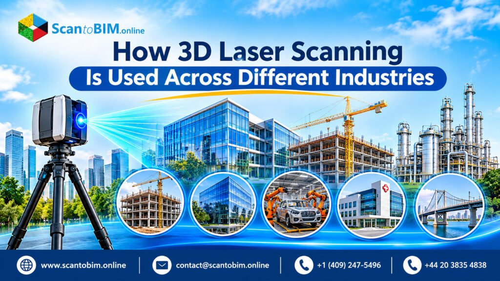
1. Construction and Architecture
Architects and construction professionals use laser scanning to document existing building conditions, verify dimensions, and support renovation planning. Point cloud data provides a detailed reference for creating accurate as-built drawings and BIM models.
2. Manufacturing and Industrial Facilities
Manufacturing facilities use 3D scanning to document equipment layouts, structural components, production areas, and complex installations. Accurate spatial information can support facility modifications, equipment planning, and maintenance activities.
3. Infrastructure and Transportation
Laser scanning supports the documentation of bridges, roads, tunnels, and transportation facilities. Detailed spatial data helps engineers assess existing conditions and plan infrastructure improvements.
4. Healthcare and Commercial Buildings
Hospitals, offices, and commercial properties can use scanning to document complex interiors, building layouts, and service areas. This information supports renovation planning, space management, and facility upgrades.
5. Historic Buildings and Heritage Preservation
Historic structures often contain intricate architectural details that require careful documentation. Laser scanning captures existing geometry and creates digital records that can support restoration planning and preservation work.
From Point Cloud Data to BIM Models
Capturing scan data is only one part of the process. Project teams often need structured deliverables that can be used during design, coordination, and construction.
Point Cloud to BIM Services convert captured scan information into intelligent 3D models representing architectural, structural, and MEP elements.
For projects requiring traditional 2D documentation, Scan to CAD Conversion Services can transform point cloud data into floor plans, sections, and elevations.
Choosing the Right Laser Scanning Workflow
Start with the decision the data will support, then work back to the capture method. Before requesting 3D laser scanning services, the project team should state whether the data is for visualization, drawing production, or a fabrication-grade model. Teams following ISO 19650 write exchange information requirements and a BIM execution plan that fix LOD, LOA, and metadata before mobilization. The capture method then follows from the tolerance:
-
- Terrestrial laser scanners suit tight tolerances, such as dense mechanical rooms. They need static tripod setups, so on-site time is longer.
- Mobile mapping and SLAM scanners cover large warehouses and open offices faster, with lower accuracy than a TLS. Confirm the achievable tolerance for the specific system first.
- Drone photogrammetry covers roofs, façades, and large sites and can be processed in the same coordinate system as interior scans.
The sector also shapes the accuracy class. USIBD’s LOA guidance lists LOA 40 for tight MEP clash detection, historic preservation, and prefab tie-ins. Laser scanning for heritage buildings and laser scanning for industrial plants therefore deserve closer scrutiny of tolerance than a warehouse floor plan does. Laser scanning for manufacturing follows a separate path, because component inspection uses systems verified under ISO 10360.
For retrofit work, ask a team offering scan to BIM services how scans will be tied to survey control and how deviation results will be reported against the specified LOA. Teams planning laser scanning for renovation should also require open formats, E57 for clouds and IFC for models, so structural engineers, MEP fabricators, and facility managers can work in separate software.
Conclusion
3D laser scanning has applications across construction, manufacturing, infrastructure, healthcare, and heritage preservation. By combining reality capture with point cloud processing and BIM modeling, organizations can turn physical environments into useful digital information.
Visit ScanToBIM.Online to explore professional scanning and modeling solutions, or use the Project Estimate Tool to review your project requirements.